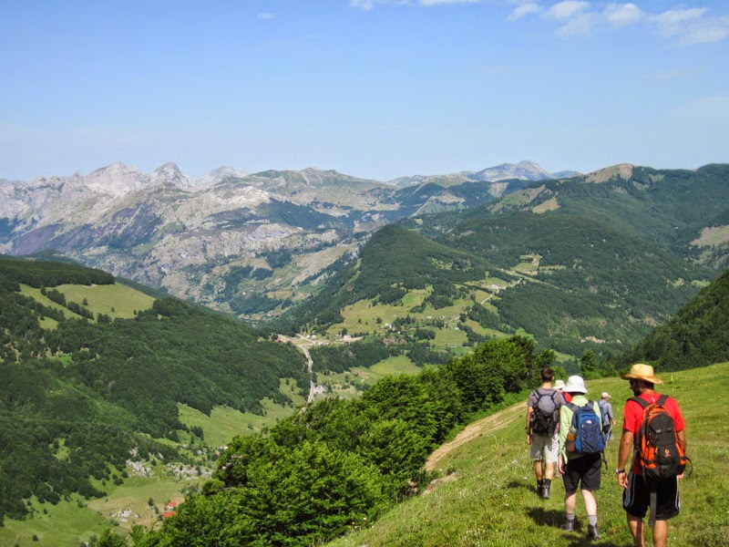
Thursday, 31 July 2014

Peaks Of The Balkans: Albania, Montenegro & Kosovo - Day 6

Day 6 - Vusanje to Thethi via the Peja Pass

12.00 miles / Total Ascent 1000m / Total Descent 1500m

After a quiet day yesterday, a more demanding one beckoned this morning: from Vusanje in southern Montenegro, over the mountains via the Peja Pass, and down into the Thethi valley - a trek of some 8 hours plus stops.

Early morning over Lake Plav

Our driver arrived on time this morning, and soon we had loaded up and set off for Vusanje in the Ropojana Valley, the starting point of our trek. On the way, we saw a Hoopoe to add to our slowly increasing tally of birdlife - this striking, colourful bird a symbol, we hoped, of superb weather developing. Sadly this was not to be: from a 50/50 start with some promise, the weather in fact deteriorated into a wet, gloomy day with limited views - a shame for such a significant day's trekking.

Blue Eye #1 (Montenegro)

Our first port of call was a spring pool marked as Oko (Eye) on the map. It looks inviting - and is, in a way - but it is freezing cold, so makes a better spot for collecting chilled drinking water than for swimming. Bottles filled, we made our way back to the trail.

Show us a sign, a glimpse of the future ...

This sign may not look much, but it is the reason we are here. We visited this same spot last July during our Montenegro & Kosovo trip, and seeing it had quite an effect on us both. I wrote at the time:

"To be honest, seeing the name Theth on the signpost proved a rather emotional moment. Realising we were less than a day’s trek away from where we had spent a fantastic time just two summers' ago exerted an almost magnetic pull ..."

There and then, it seems, we made a vow that one day we would come back to complete the walk and make the link. Now, barely a year later, that day had come, although at the time we had no idea it would be so soon, if at all. And, coincidentally, we would be arriving in Thethi on 11th July - the exact same date we arrived there the first time three years ago. Coincidences, connections, compulsions: I'm a firm believer that if things are meant to happen, they will.

Waiting for the mules

Another thing I believe is that things are far more easily said than done, and there was work still to do if we were to make Thethi by the end of the day. Hard work, as it turned out, as the muleteers we were supposed to be meeting were not in evidence, so the for the first three-quarters of an hour we flogged up the road in deteriorating conditions with both day packs and full luggage while Endrit sped ahead to try to find them.

Mule and muleteer

In the end, it simply came down to a misunderstanding about exactly where our rendezvous would take place - an easy enough discrepancy under the circumstances. Soon, though, we were all united, the mules were loaded, and we were on our way once more.

Mule train

Unfortunately, the rain had set in in earnest, and mist prevented us from seeing the impressive summits that line the sides of the valley. Still, we got "atmospheric" in a big way, as well as wet, and somewhere round here we passed the toppled border post that signalled our return to Albanian territory.

Looking back from near the top of the pass, mountains hidden in mist 

Once off the track, the trail rises in a series of steps: sharp climb, followed by flatter area, followed by sharp climb. During a brief drier spell, we stopped for lunch, then carried on. As we approached the pass the climb steepened, the ground became rockier, and soon we could look back over our route so far and at the mist obscuring the mountain tops.

Rocky mountain way

The next half an hour was spent following a convoluted route through bumps and hollows of shattered rock, and marked a change between the relatively easy-going paths so far and the stonier ones to come. Eventually, though, we came to the flat corridor that marks the top of the pass at around 1700m.

Peja Pass - 3 years ago we reached this point from Thethi on a boiling hot day

We knew from before that the descent to Thethi was steep, rocky and festooned with loose stones. Last time we were here, though, it was incredibly hot - 40C was recorded in Shkodra in the shade that day - so today's visit was markedly different, being probably about 15C.

Views into the Thethi valley from the top half of the descent

We set off down the path into the Thethi valley. Normally, this would offer amazing views of the valley and the surrounding peaks: today, though, the sight was more akin to that of a wet November Tuesday in England.

Views into the Thethi valley from the bottom half of the decent

We did eventually descend below the cloud, although the drizzle continued - as can be gleaned from the rain-smeared photo above. The mules were less bothered by the lack of views, but didn't like the relentlessly steep, loose path - one lost a shoe - so we were all quite relieved to reach the relative safety of more level ground in the valley bottom.

Arriving into Thethi

It was good to be within sight of our destination as we plodged the last mile or so into the village. We were to be staying two nights in Thethi, so at least there was a chance to dry out wet clothes and get warm and comfortable.

We were intrigued as to where we might be staying in the village, given the relatively few options encountered last time. Somewhat to our surprise, we found it was the same place as last time. Very much to our surprise, we found it was now three times the size and much smarter than before (when it was a much simpler breeze-block-and-corrugated-iron-roof affair). It just goes to show how tourism is affecting even the most remote places.

Our accommodation in Thethi

The same guesthouse 3 years ago

The rooms were nice (we shared 3 to a room) with en suite bathrooms, and we were able to scrub up and dry out. We were also treated to a great dinner - grilled lamb, salads, bread, coleslaw, and watermelon for afters - and beers, too!

For some reason, we were all early to bed.

Wednesday, 30 July 2014

Peaks Of The Balkans: Albania, Montenegro & Kosovo - Day 5

Day 5 - Crossing Into Montenegro

2.50 miles / Total Ascent 100m / Total Descent 100m

Today was primarily a transfer day, crossing the road border between Vermosh (Albania) and Gusinje (Montenegro). This involved two checkpoints, 50-odd metres of no-man's-land, passports (which were stamped) and a certain quantity of time. 

The day got off to a slightly inauspicious start. Firstly, it was raining, and whilst not particularly heavy, it had the look of being set in for the day. Secondly, we were running slightly behind time because a) Endrit hadn't been able to make contact with our pre-arranged transport (who was apparently away in Kosovo, anyway!), b) the revised option organised the previous night simply didn't materialise, and c) further transport possibilities for six people and all their luggage at short notice in a remote northern Albanian valley were, for some unknown reason, scarce.

Gloomy weather in the Grbaje valley

However, as is the way of things, Endrit got it all sorted, and by 10.00am were heading east towards the border on a road of variable quality. Crossing safely negotiated, we passed through Gusinje and headed into the Grbaja valley, where we went for a short walk: nothing too exciting as we had time to make up, but with intermittent views through the trees and sightings of a large Owl and a Greater Spotted Woodpecker to boost our mood, it helped combat the lethargy of a slow morning.

Heading back into Gusinje, we then took the road out to the Ali Pasha Springs, where we had a large lunch (Goulash) and a short walk round.

Ali Pasha Springs (after John Constable)

Next, we passed through Gusinje again, stopping briefly so that Endrit and Tony could pick up a cab. Motoring regulations are more strict in Montenegro than Albania: apparently seven people and copious luggage crammed into one vehicle is an offence. Can't think why?

Anyway, we then made the 30 minute transfer to Plav and our lakeside hotel at the Komnenovo Ethno Village. We arrived mid-afternoon, giving plenty of time for R&R. Reviews of this hotel had been mixed, but we found it to be nice in a timber-hunting-lodge kind of way, with huge, comfortable rooms (one all to ourselves!) and all mod cons - quite luxurious, by recent standards.  

Hotel Komnenovo (Ethno Villege, Plav)

This evening, we had planned to meet up with Dimitrije (our friend and guide from last year's Montenegro & Kosovo trip). As communication in remote northern Albania is sporadic, we hadn't been able to get a message through, and were not sure if he could make it. However, come the appointed time, a familiar red car arrived at the hotel, with not only Dimitrije inside, but wife Tijana and baby daughter as well! We found a quiet restaurant in the centre of Plav, and had a really good catch up.

All to soon, it was time to go our separate ways: Dimitrije and family back to Bijelo Polje, and us to dinner - chicken, a Serbian salad (green salad with green chillis in) and the traditional Montenegrin dish of kacarmac. Delicious!

After an easy, lazy day today, it's back to trekking with a vengeance tomorrow, so an early night was had by all.

Tuesday, 29 July 2014

Peaks Of The Balkans: Albania, Montenegro & Kosovo - Day 4

Day 4 - Lepushe to Vermosh via Greben Peak

9.10 miles / Total Ascent 820m / Total Descent 1110m

Breakfast, as usual, was taken early in the morning - and a fine morning it looked to be as well. We were moving on today, so as well as all the packing there was time needed for a round of thanks and goodbyes to Ilya and his family for their hospitality. This stop genuinely felt more like a homestay than a guesthouse: we had been looked after well and made very welcome in their home.

Readying to leave

We were again to have an additional local guide today - this time, Ilya's wife. I never did properly find out the names of Ilya's wife and sister, and was cautioned it was impolite to ask - this being an area of very traditional customs and beliefs. 

The view northwards along the valley

Yesterday's walk took us into the hills to the southwest of Lepushe. Today we were heading northwards, over the ridge into the village of Vermosh via the rounded summit of a low peak called Greben (1840m). The weather was fine as we left the village via a forestry road that climbed gradually up the hillside.

Stane, with the Berizhdol ridge on the horizon

Before long, we left the track for paths that took a more direct route upwards, every now and again crossing the forestry road. Eventually, we reached an open area of meadow beside a stane. We had to watch where we were putting our feet as the grass was teeming with young chicks - Endrit said they were called something like Rock Chickens. This sounds more like a local name than an exact one, and I suspect they are young Rock Partridges, which are quite widely found in the upland areas of this region. 

Young chick: there were dozens scurrying through the long grass

We carried on, climbing once more through woods before reaching open ground again, with views to the far peaks all around. Then it was just a short stroll up to the summit. In the space of under half an hour, though, dark cloud had begun to build. It had come much cooler, too, and there was a definite sense of rain in the air as we posed for pictures.

The group on Greben summit, dark clouds racing in

So we didn't linger too long. Greben is not the highest or most testing of summits, but it is somewhat exposed and breezy enough that getting wet would have been uncomfortable, and there can always be thunder and lightning when the rain comes.

Once off the top, we made a short stop for drinks and a snack, then began the descent into Vermosh. Before long the clouds dispersed, the sun came out again, and we ambled past more of the idyllically situated summer farms.

Sheep being driven up to graze on the pasture

Continuing the descent, we passed sheep and cattle being led up to the good grazing. Ilya's wife knew one of the old ladies driving the animals, so we stopped for a brief chat. The hillsides in these areas look to be open to anyone for grazing, and that would be the case according to the authorities - there are no walls or other boundaries to divide the areas up. But all the locals know which family has the grazing rights to a particular area, and these divisions are well-respected. 

Crossing the stream

We continued on our way down, crossing streams and stopping to pick wild strawberries. Lunch was taken on a small piece of flat ground beside the trail with logs and stones for seats and more wild strawberries to pick. It was a very relaxing spot, and we all ended up having a brief snooze in the sunshine.

Wild Strawberries

The final descent was by way of a steep, rocky path, strewn with loose stones and perfect for a slip or a tumble. So we took our time, so as not to fall or turn an ankle. Eventually, we reached the village and the road. Ilya's wife grew up in Vermosh, and asked if we would like to meet her parents. Of course, we said yes!

Turkish coffee and raki (note the respective sizes)

Albania hospitality being what is is, it wasn't long before offers were made for coffee, tea, cake and raki. Again, we said yes! The old man came out and sat with us. Via Endrit, he told us some very personal stories about his life under the Hoxha regime. For no reason other than heresay, he was arrested and forced to work in the mines for 15 years, only being freed in 1990 after the regime collapsed. It was a harrowing time - some of the things he witnessed should not have to be seen by anyone - and he said he struggled to come to terms with life back in the village on his return. While he was telling us these stories, two eagles could be seen soaring above the ridgeline - a poignancy that was not lost on us.

The old man and his wife by the door to their house

After this wonderful show of hospitality, we went to check in to our guesthouse. However the owner wasn't about, so we went to a nearby bar for beers, and bumped into a Polish couple from Wroclaw who were doing a motorcycle tour of the Balkans.

Guesthouse in Vermosh

Eventually, though, the guesthouse owner returned and we checked in. Our accommodation was in small rooms in a log cabin, with comfortable beds and each with an en suite bathroom - very nice! After showers, we went for dinner: Endrit had to go and sort transport for the following day, so we were on our own for dinner. The owner didn't speak English, and we didn't speak Albanian. Happily we found we did have a common language, though, and the meal was conducted in French. Et voila! noodle soup, grilled meat, salads and potatoes, with fruit for afters, and beer, coffee and raki to finish. Excellent!

Lulled into another soporific state by fresh air, exercise, alcohol and too much food, we all turned in by about 9.30pm.

Monday, 28 July 2014

Peaks Of The Balkans: Albania, Montenegro & Kosovo - Day 3

Day 3 - From Lepushe

8.13 miles / Total Ascent 1037m / Total Descent 967m 

As was to become customary, we woke early to breakfast and be on our way by 7.30am to combat the expected midday heat.

Heading out of Lepushe

We had an extra local guide today in the form of our host's sister, and our route began with a steady climb out of the village, ascending through woodland to gain the higher ground below the Berizdhol ridge. The village itself is situated at around 1200m altitude, so it was nice and cool as we gained height. 

Albanian football team elite high-altitude training facility 

After a while, we exited the woods and began crossing the grassy hillside. Unexpectedly, we came across a makeshift football pitch on an area of flat-ish ground beside some tumbledown buildings - a legacy, I think, of the Hoxha regime. We took a short break, and made jokes about the relative merits of these facilities and those of the multi-million pound England football failures. 

World cup? What world cup? Penalty spot, goal, keeper and cameraman.

From here we ascended the grassy slopes behind the goal to reach the ridge and an excellent viewpoint at around 1900m. Several paths fanned out from here, including at least one leading to the higher summits. 

Looking wistfully at the higher summits beyond

Heading for the higher ground was tempting, but our route lay in a different direction - following a line around the base of the mountain amphitheatre.  

The Kelmend Valley, with Lepushe in the middle ground

From here, we dropped down through a wooded section, dappled with sunlight through the trees, to reach one of the numerous small farmsteads that dot the hillside in these parts. Called stane, they are mostly occupied only during the summer months, when the animals are driven to these higher levels to graze on the excellent pasture, and families make cheese, shear wool, collect mushrooms and pick fruit for preservation to last through the winter months.  

Stane near Lepushe

Despite the remote nature of this area, it was around here we happened to bump into a group of scouts from Tirana. We had just sat down to talk to the shy children from the farm, when a whole herd of be-woggled girls and boys appeared from over the hill. We said our hellos - in fact had quite a chat -  then went our separate ways, which I think was a relief for both parties, and the children. 

Wild Violas

Moving on, we followed a narrow balcony path that threaded an intricate route between trees and rocks, eventually coming out to more open ground near another stane, where we stopped for lunch. There had been the odd spot of rain as we walked through the trees, but as we reached the meadows the sun was strong, so we ate our picnic quickly and moved on to a shadier spot beside a cool stream for a rest.  

Downtown Lepushe: bar on left, school straight ahead

The remainder of the walk was a steady descent on paths and tracks through woodland to eventually reach downtown Lepushe. We stopped at the bar for beers, and bumped into a couple of New Zealanders who were on a warm-up walk prior to do the Peaks of the Balkans hike.  

Heading back to our guesthouse

Then it was a short trundle down the road back to the guesthouse, where we had plenty of time before dinner for a rest, showers and a read. 

Peaks Of The Balkans: Albania, Montenegro & Kosovo - Day 2

Day 2 - Shllapit Waterfall, Selca

9.20 miles / Total Ascent 1235m / Total Descent 885m

We were on the road shortly after 8.00am, leaving Shkodra and heading for the mountains. For a while we drove across flat ground with lake Shkodra to our left, heading towards the northern town of Hani I Hotit, then struck off into the mountains on a minor road that paralleled the Montenegrin border. 

Initially the going was good, as we wound up into the hills on a metaled road. Beyond Rrapsh-Starja, though, things changed, and we plummeted on hairpin switchbacks down a near-vertical mountainside into the next valley on a rough, unmade road that was in the process of being repaired. Welcome to Albania!

The road into the Kelmend Valley
(Photo courtesy Marianne van Twillert-Wennekes/www.montenegro-for.me)

By now, we were definitely "off the beaten track". The Kelmend Valley is considered remote, even by the standards of the area, and is certainly spectacular - as the descent into the Cemi gorge proved. The Montenegro border, in places barely 1 kilometer away, tracks the crest of the steep-sided mountains opposite, the summits towering almost a vertical mile above the valley bottom.  

We made a brief stop for refreshments in the village of Tamarja (where Aleks, our guide on a previous Albanian trip, grew up) then carried on to Selca along the unmade road - a journey that offered a full body workout as we were thrown hither and yon inside the van! 

Setting off from the road at the start of our first walk

The walk to the Shllapit waterfall starts from near Selca (the track in the above picture being the main road through the valley). The going was quite gentle at first, but it was already quite warm (though nowhere near as hot as it was when we last came to northern Albania) and there wasn't much in the way of shade. However there was plenty of water available, and we drank our fill as we climbed.

Looking back on our route: path on the left

River crossing

As the ravine narrowed, we threaded our way back and forth across the river, accumulating height as we went. Although we had to push through some thick bushes as we rounded the end of the valley, the path was quite clear for much of the way, and we reached the waterfall in good time.  

Shllapit Waterfall


Spray and rocks

We took our lunch on a grassy bank overlooking the falls, keeping to the shade and taking advantage of the cooling breeze and the fine mist carried by it.

The falls as seen from our lunch spot

After lunch, we carried on - climbing through woods up the hillside to reach the higher ground beyond. For some reason I was feeling the heat a bit, so I stopped for a short break, took some rehydration salts, and in no time at all felt much better. 

Meadows and mountains

At the top of the climb, we came out from the trees to reach flat pasture and signs of life: first a barn; then houses; then people, going about their backbreaking work in the full heat of the day. Tough people, these highlanders.  

However, there was an idyllic quality to the scene - beautiful meadows, sunshine, high peaks and fantastic views - that almost made the toil required to survive here seem appealing.

Through the hay meadows

We began the gradual descent back towards the road, passing the hamlets of Mregu and Ostrici on the way. For the most part the going was easy enough, although on one loose, steeper section I slipped and ended up grazing both elbows. How do you manage that in one go?

Finally we reached the road, and met up with Ilya, our host for the next two nights. The mini van that had brought us to Kelmend that morning had returned to Shkodra, so now we had to squeeze seven of us and all our luggage into Ilya's 4 x 4 - which was cozy, and not always comfortable on the rough roads. Still we all got there in one piece, and I managed not to leak blood all over the upholstery.

We arrived at the guesthouse at about 6.30pm, so there was only time for cups of tea and quick showers before dinner. We had a variety of local foods, plus beers and homemade Blueberry raki - a lovely way to relax and end the day. What with fresh air, excercise, food and drink, an early night was had by all.

Today's was a good walk, with quite a bit of variety and some great scenery. All in all, it was a reasonable undertaking given the late morning start. And, as a warm-up walk, it served the purpose well - having both warmth and up! - and even the few minor mishaps along the way could do nothing to spoil the sense of an excellent first day.

Friday, 25 July 2014

Peaks Of The Balkans: Albania, Montenegro & Kosovo - Day 1

Day 1 - Arrival

It has to be said: the start of a new hiking trip is always an exciting time. Anticipation is high, and no matter how well or how long one has prepared for the trip, the rush to change from work mode to holiday mode can be tricky transition. Tiredness from the often ridiculously early morning transfer to the airport, coupled with any last minute packing crises, also means that a smooth journey is a real boon.

And so it proved to be, as we arrived into Tirana airport on time (about 10.45am local time) and met the rest of our group: guide Endrit, Tony who we met before in southern Albania last year, Matt from the Walks Worldwide office (but who was here on holiday, not for work) and Rebecca from Australia via The Hague.  

Rozafa Castle

It was quite warm - around 27 degrees outside - so, after brief intoductions, we settled in somewhat sleepily for the 90 minute transfer to Shkodra. On arrival, we had a relaxed lunch at a riverside restaurant beside river Drin (me Trout, Missy G vegetable Risotto) before a tour of Rozafa Castle, an imposing fortress perched on a rocky bluff near the confluence of the Drin and Bojana rivers.

Confluence of the rivers Drin and Bojana

Shkodra is the principal city of northern Albania, with a population of around 100,000. It is one of the oldest and most historic places in the region, dating back to Illyrian times (3rd Century BC). In 168 AD, the town was captured by the Romans, and became part of Dalmatia (and eventually Dacia). More recently, in the 15th Century the area was secured as an Ottoman territory: with access to the Adriatic coast as well as inland to other major cities (such as the other major Ottoman city in the region, Prizren) it also has a great geostrategic importance as well. 

The early 20th Century saw further changes/occupation as a result of the first and second Balkan Wars and the shakedown following World War 1 when the whole Balkan region was divided up and divvied out by the then major European powers - a notoriously complex and unsatisfactory state of affairs that has led to trouble and conflict ever since.

Looking over Shkodra to the mountains
 
Rozafa Castle was originally built as an Illyrian stronghold, strategically situated at this influential location. Captured by the Romans, it has since also passed through Byzantine, Serbian, Venetian, Ottoman and Montenegrin control.

There is a legend associated with the castle, about the initiative of the three brothers who set about building it. They worked all day, but the walls fell down at night. They met a clever old man who advised them to sacrifice someone so that the walls would stand. The three brothers found it difficult to decide whom to choose: finally, they decided to sacrifice one of their wives - the one who would bring lunch to them the next day - and they agreed that whichever of their wives did so would be buried in the wall of the castle. They also promised not to tell their wives of this: however, the two older brothers explained the situation to their wives that night, while the honest youngest brother said nothing.

The following afternoon, the brothers waited anxiously to see which wife was carrying the basket of food. It was Rosafa, the wife of the youngest brother. He explained to her the agreement that they had made, namely that she was to be sacrificed and buried in the wall of the castle so that they could finish building it. 

She did not protest, but accepted to be walled in on condition that they leave her right breast exposed to feed her newborn son, her right eye to see him, her right hand to caress him and her right foot to rock his cradle. It is said that milk still flows from one of the walls in the castle.

Central mosque: we had dinner near here

We checked in at the hotel, then the rest of the afternoon was free time to rest, wash, and walk out into town. In the evening, we walked into main pedestrianised centre of the town, and ate dinner on a balcony restaurant near the central mosque: salad, grilled vegetables, a spicy vegetable and sausage casserole, melted cheese fondue, beef steak, and masses of it. Lovely! 

Sunday, 11 May 2014

Norfolk Coast Path - Day 4

Sheringham to Cromer - 6.50 miles

And so to our final morning, and the last few miles into Cromer. We rose early again, breakfasted, packed up our stuff and drove to Sheringham, where a trundle down the high street brought us to the sea front to rejoin the NCP.  

Sea front, Sheringham

We briefly followed the front, passing rows of unoccupied beach huts before cutting inland by the Wee Retreat - a crumbling former public convenience now converted into a stylish compact and bijou residence. Then began the arduous ascent of Beeston Bump, a pudding-shaped protuberance standing at a colossal 63m above sea level. 

Looking back over Sheringham from Beeston Bump

We stopped briefly at the trig point to gulp lungfuls of the rarefied air, and look back over Sheringham and along the coast. Next, in another unexpected twist, the path cut inland, crossing the busy A149 road and skirting the edge of Beeston Hall School. 

Quiet tracks

A series of quiet tracks led gently upwards towards the ridgeline. Gradually the countryside became more heath-like, and the route morphed from track into woodland trail as we wound our way up to the top of Beacon Hill - the highest point in Norfolk at a whopping 102m - whilst the sun shone briefly and birds twittered in the trees all around.  

And shady trails

Beyond Beacon Hill, the path threaded it's way between a patchwork of caravan parks and camping sites. The rural facade began to slip as we neared Cromer, and before long the trappings of suburbia could no longer be held at bay. From field, to houses, to main road - in a flash we were in the town.

We found a bench, drank coffee and ate Creme Eggs. Then it was a final trundle through the streets to the pier, and the end of the walk. Like many seaside towns on a gloomy out-of-season day, Cromer had a slight seen-better-days atmosphere to it this morning. As we took our final few paces, the sunshine faded and a light drizzle, blown by the wind, brought a lugubrious air to the place - a metaphor that was not lost on us.

The end!

After a quick photo to record the end of the walk, we turned on our heels and headed for the train back to Sheringham. It felt quite peculiar finishing the walk so early in the day - it was barely 11.30am - and stopping altogether would have seemed somehow unsatisfactory. So we had a celebratory Crab sandwich lunch in Sheringham, the headed back to Cley for a gentle amble and some more birdwatching.

Overall, we'd really enjoyed our jaunt along the north Norfolk coast. Despite being predominantly flat, there are enough changes of scenery, varying underfoot conditions and regular pretty villages and harbours to maintain the interest throughout. For those with an interest, the birdwatching is great, too: in spring, this coastline is one of the best places in the UK to go. And it's ideal for a long weekend - with time to complete the route and travel there and back in just 4 days.

We are already considering our next trip to Norfolk. By combining the NCP with the Weaver's Way, the Angles Way and the Peddars Way, it is possible to circumnavigate Norfolk, and I reckon it'll not be long before we are out this way again.