Showing posts with label Pennine Bridleway. Show all posts

Sunday, 11 September 2016

A Dash To Dentdale

We have always enjoyed our trips to Dentdale, a beautiful part of the country we have been visiting regularly for over 25 years.

In recent years, our visits have become rather fewer and further between, but the August Bank Holiday weekend provided the perfect opportunity for a brief re-acquaintance and, although more succinct than we would have liked, it was just the tonic we needed after a busy few weeks.

We did a bit of pottering about on Saturday afternoon after the drive up in the morning, but during the next two days we managed a couple of decent outings. On Sunday, we walked from our digs along the Dales Way to Sedbergh and back. 

Rosehips ripening


The rivers were full after heavy overnight rain


Cloud just lifting from the top of Middleton Fell

Although August by date, there was clear evidence that Autumn was fast approaching. Rivers were swollen from recent rains, blackberries were already ripe in the hedgerows, we picked wild raspberries as we went. 

Looking towards the Lune Valley


From the hillside on the way into Millthrop, we could see the restored
Pepperpot building in the grounds of Sedbergh School


Returning through Dent village


Nuthatch on the bird feeder

Monday dawned rather brighter, and we chose a walk that gained height above the dale, affording great views to almost all points of the compass.

Denthead viaduct on a brighter morning


Picking up the Pennine Bridleway


It's a National Trail!


Looking back towards Ingleborough and Pen-y-ghent


View from near the top of Arten Gill


Soaking up the far-reaching views on a perfect day for walking,
with the mountains of the Lake District in the far distance


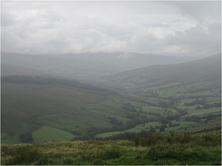
Dentdale laid out below us in all its glory


Back in the dale, the rivers are quieter today


Sunlight catching the peat-stained waters of the River Dee

Thursday, 5 September 2013

Great Expectations

Earlier this year – Easter Sunday, in fact – we did a walk comprising upper Dentdale, part of the Dales Way, and a stretch of the Pennine Bridleway above Dent Station. It was a chilly affair, with ice underfoot and deep snowdrifts to contend with, but great fun nonetheless! Details of that outing are:


In the course of that circuit, we discovered a permitted path over Great Knoutberry Hill and made a decision there and then to come back and tackle it in better weather. Today was that day.

The forecast was good, but, as we set off, the weather tripped a tightrope between summer and autumn. One moment, conditions were overcast, with a cool breeze and hint of rain flecking the air; the next, blue skies and fluffy white clouds predominated, and the sun was warm on our faces.

A reasonable start to the day

We have walked the route through upper Dentdale numerous times: a string of familiar paths and lanes roughly following the course of the Dales Way, walked in all seasons and all weathers. Lea Yeat, Cowgill, Dent Head: places as familiar to us as home, but which never fail to delight.

Steam train crossing the Dent Head Viaduct

Climbing out of the dale towards Newby Head, we turned to watch a steam train cross the Dent Head Viaduct on the Settle-Carlisle line. We fell in with a couple tackling the Coast-to-Coast cycling route, whose forward progress was temporarily moderated by the steepness of the hill. We got chatting: their next overnight was in Thirsk, some fifty-odd miles away, giving them plenty to do in the day. So, as soon as the gradient lessened, they were off again. We wished them well, and turned our attention to more immediate matters.

Newby Head & Three Peaks country

At the junction with the Pennine Bridleway, we turned for home and followed the rising track on to Wold Fell. Being out in the open, the breeze was making itself decidedly felt, so we stopped for lunch in the shelter of a drystone wall with a view overlooking Three Peaks country.

As we were eating, we could see a couple slogging their way over the rough, boggy ground of the adjacent field. Now I’ve got nothing against bog-trotting or off-piste walking in the slightest: indeed, some may say it’s our stock in trade. However, as there was a perfectly good track this side of the wall we suspected they might be temporarily misorientated. This turned out to be so: in fact they had been following the Ribble Way and were looking for the source of the river. Unfortunately, they had ended up on the wrong hill. But no matter: all the paths they needed were in plain sight, and we soon had them on the right track again.

At the top of Arten Gill

The top of Arten Gill marked our departure from the previous route. Instead of following the PBW along the contour, we turned right towards Widdale, then took a left over a stile and on to Access Land, where a semi-clear path meandered beside the wall, assiduously trying to avoid the wettest bits.

Trig point on Great Knoutberry Hill with Wild Boar Fell behind

A steady climb brought us on to the top, where we were confronted with 360° views of the surrounding countryside. At 672m, Great Knoutberry Hill ranks as the sixteenth highest fell in the Yorkshire Dales, something that might explain it’s relative anonymity. It’s no giant, but neither is it a minnow: what it lacks in stature, it more than makes up for situation, for the view encompasses an entire skyline of more sexy summits – the Three Peaks, Great Coum & Crag Hill, Calf Top, The Howgills, Wild Boar Fell and Great Shunner Fell to name some of the more alluring.

Cairn on Pike Edge with Ingleborough behind

A pair of tempting looking tarns lay just to the north of the trig point, but our route took a westward bearing to descend over Pikes Moss, where a series of cairns marked the line of Pikes Edge.

Some cairns are quite large

Below Pikes Edge, we rejoined the Pennine Bridleway, made our way to the Coal Road and descended into Dentdale past Dent Station. We took a short break by the bridge at Lea Yeat, then followed the Dales Way back to the start.

As described, this circuit might be a bit heavy on road walking and a bit light on hill time. But it suits us as we can do this from our digs without moving the car, and at 14.25 miles plus around 890m of ascent/descent it’s a pleasantly satisfying day out.

Looking over upper Dentdale

To my mind, upper Dentdale is beautiful. However, I know others disagree, citing the road walking between Dent Head and Lea Yeat as one of their least favourite sections of the Dales Way. I guess it will always divide opinion. But one thing I think can be agreed upon is that Great Knoutberry Hill is a superb vantage point for Dentdale and the surrounding hills.

Rather like the bass player of the band, who is often overshadowed by the singer, the guitarist and even the gonzo drummer, it is a stalwart whose contribution would be missed if absent.


Why not see for yourself?

Thursday, 27 June 2013

Almost Groundhog Day: Cromford to Turnditch again – Approx 15.25 miles

Sunday 23rd June 2013

Map: OS Explorer OL24 – The Peak District – White Peak Area
Map: OS Explorer 259 – Derby, Uttoxeter, Ashbourne & Cheadle

Cromford Hill – Cromford Wharf – Derwent Valley Heritage Way (S) – High Peak Junction – High Peak Trail – Black Rocks – Middleton Top – Hopton – Carsington Water (East Shore) – Oldfield Lane – Kirk Ireton – Field Lane – Broad Way – Gorses – Ireton Wood – Jenny Well – Cross o’ th’ Hands – Turnditch – Cowers Lane

Arrive Turnditch at 9.00am: check. Catch bus from Cowers Lane around 9.20am: check. Alight in Cromford about quarter to ten, as the rain started in earnest, ready to walk back to Turnditch: check. This was yesterday, right?

Well, yes.

And no.

That’s because it’s today as well.

I originally thought I’d walk somewhere else today, but last evening was busy and I’d done no further preparation. Instead, there was a nagging feeling in the back of my mind that yesterday’s excursion hadn’t quite worked out as well as I’d hoped, so I thought I’d have a go at my other Cromford to Turnditch route. If nothing else, it would provide an interesting “side-by-side” comparison of two routes that share a start and end point but vary significantly in the middle.

Looking over rainy Cromford
Once again, I picked up the Cromford Canal for the first part of the walk. And, once again, it was raining – but this time harder and with much more intent than yesterday.

High Peak Junction
Today’s route was the more high-profile western option I mentioned yesterday, taking in the High Peak Trail and Carsington Water. So, instead of continuing along the canal at High Peak Junction, I picked up the High Peak Trail and began the long, steady climb towards Black Rocks.

1 in 8 Gradient: steep for trains - and people 
For those that aren’t aware, the High Peak Trail follows the bed of the former Cromford and High Peak Railway (built to connect the Cromford Canal with the Peak Forest Canal at Whaley Bridge, and closed after the Beeching Report) and meets with the Tissington Trail at Parsley Hay. Along this stretch it climbs via a series of inclines by around 250m at a gradient of 1 in 8, quite a feat of engineering when it was built in 1831.

Middleton Top Engine House
At Middleton Top, the Engine House built to haul wagons up the Middleton Incline is still in existence, and the massive steam engine still operates on certain days for visitors to see (it’s an impressive sight!). Nowadays, it marks the beginning of the Pennine Bridleway: there is also a visitor center, snack bar, gift shop and cycle hire center for your enjoyment, if impressive relics of the Industrial Revolution don’t suffice.

A little further on, I left the High Peak Trail and stuck off across the fields towards Hopton. I must admit that at this point I was giving some thought to cutting the walk short. It had been raining quite heavily all morning, was cold, dull and gloomy, and the initial enthusiasm seemed to be waning a bit – perhaps understandable, given it was the 23rd of June and it should be summer by now!

Anyway, I decided to carry on, and picked up the path that circumnavigates Carsington Water, keeping to the eastern side of the lake. This is the quieter side, and although no Ladybower or Thirlmere or Lake Vrynwy, its a good place for birdwatching and can be walked without meeting the hordes that congeal around the car parks and hot spots on the north and west shores.

First glimpse of Carsington Water: cold, wet and windy
I stopped briefly for a bite of lunch, but it was cold and windy, so I didn’t linger. Instead, I carried on, leaving the lakeside to head across the fields towards Kirk Ireton.

Near Kirk Ireton
As villages go, Kirk Ireton is a bit of a bugger to get to. It requires careful navigation of the car through a network of narrow, winding lanes, and would be off most peoples’ radar if it weren’t for one thing: it has a great pub! As a youngster, I remember The Barley Mow being spoken of in reverential tones. It is a tiny place – more like a house, really – and one of the apocryphal stories is that back in the 1970s, shortly after decimalisation, the elderly landlady operated a system whereby you got your beer at the bar, took it to a nearby table to pay where she converted the price and the money you proffered into old money (pounds, shillings and pence) calculated your change on that basis, then converted it back before giving you your change.

The Barley Mow
The good thing is its still going, but there’s not a single hand pump in sight! Fear not, real ale fans, for things are different here: all the beers are dispensed directly from the barrel, without the need for any of those mucky pipes! My pint of Derbyshire Pale Ale came and went in no time at all.

The last few miles linked field paths with some of those narrow lanes to strike a line in a roughly southeasterly direction towards Turnditch. The land in these parts consists of a series of vales and ridges, and there were some fine views to be had from the higher reaches of this undulating route.

Waterproofs watch out: one of several unfriendly stiles
Apart from a couple of fields of thigh-high weeds (that required one to lift one’s knees to one’s armpits every step, or were flattened by the wind in such a way as to be a trip hazzard) all was going well. Until, that is, I decided to walk the penultimate mile across the fields rather than along the lane. A couple of fields shy of the road, I got into a right tangle of unmarked path, awkward routing, overgrown hedges, nettles, thistles, bog, barbed wire, impassable undergrowth and impenetrable trees whose navigational challenges defeated me. In the end I beat my own path to the road, and, having sneaked through a few gates that felt suspiciously like trespassing, rather surprised myself when I arrived at the fingerpost.

Church at Turnditch (taken yesterday)
A final stretch along the road brought me to the end of the walk. I think it safe to say that apart from the weather and the short difficult stretch near the end, today’s route had been the more enjoyable, although the easterly route did have its merits. The real problem in both cases was finding a satisfactory route across the valley of the Sherbourne Brook, which has to be crossed to get to Turnditch from either Kirk Ireton or Idridgehay (unless a lengthy diversion is made) and which is seeming full of boggy, badly marked and generally uncared for footpaths.

It may be that there is a decent route struggling to get out of the two completed this weekend, or it may be that an entirely new route needs developing – I’ll have to give it some thought. Either way, it made good use of a dodgy weekend weather forecast, and was an interesting experiment in route planning in off-the-beaten-track countryside.

Saturday, 6 April 2013

Easter In Dentdale – Day 3

Upper Dentdale & The PBW – approx 14.35 miles

Sunday March 31st 2013

Map: OS Explorer OL2 – Yorkshire Dales Southern & Western Areas

Dentdale – Ewegales Bridge – Lea Yeat – Stonehouse – Cowgill – Dent Head – Newby Head – Pennine Bridleway (N) – Dent Fell – Coal Road – Dent Station – Lea Yeat – Ewegales Bridge – Dentdale

Another chilly morning dawned, this time without the mitigating warmth of the sun. So it was under slate grey skies that we set off up the dale.


Suffering no ill effects from yesterday’s outing, we felt we were beginning to get back to something like proper fitness again. Considering what we have coming later in the year, this is good news! But we wanted another reasonably testing outing – one with a mix of distance and difficulty – to satisfy ourselves we are close to being ready for consecutive full days on the trail.

The first part of the walk was a trundle up the dale – essentially following the Dales Way via Ewegales Bridge, Lea Yeat and Cowgill to Dent Head viaduct. Some Dales Way-ers decry this part of the route, claiming that the lengthy road walk detracts from the experience as a whole, and instead take a higher route via the Craven Way from Ribblehead across the flanks of Whernside. But we (and others, happily) are of the opinion that Upper Dentdale is a unique place with a special atmosphere, and worthy of its place on the route.

Anyway, I digress.

Pottering up the dale is easy enough going. In compensation there is plenty of “countryside” in evidence to add interest to the journey – including some of the more arcane practices.


Later in the walk, we came across Crows tied similarly to the fence. Presumably, they are killed because of a perceived threat to young lambs, but I must admit I thought this type of practice – at least as far as Crows are concerned – had pretty much died out?

As if we needed any reminding, winter is still proving hard to shrug off: what little water there is still subject to its icy grip.


Just below Dent Head viaduct we paused for a quick break, glad of the chance for a hot drink and a quick bite. A bite of a different kind came as we passed under the viaduct and out on to the more open ground of Blea Moor – a powerful, icy wind nipping at any uncovered skin. Jackets were donned.


At the junction with the Pennine Bridleway we turned for home. Climbing away from the road along the stony track, with snow-capped Pen-y-Ghent and frozen Ingleborough visible away to the south, it was as if we had suddenly been transported to Narnia or the arctic tundra of the far North.


Soon, though, the hard work of the day was to begin in earnest. As we rose higher, the snow became deeper and the going more energy sapping. By the time we reached the top of Arten Gill we were ready for another break, so we found as sheltered a spot as we could, made more hot drinks and ate our lunch.


The next section – below Great Knoutberry Hill, as far as the Coal Road – made for a real wintry experience. The prevailing winds, funnelled along the dale, had driven the snow into sizeable drifts.


Plenty of fun was had floundering through the drifts. For some reason we found the gates easier to negotiate than usual, and the low-level signage provided a different perspective.


On reaching the Coal Road we found the way over to Garsdale completely blocked to traffic by the drifts. How long this might take to clear is anyone’s guess, but it’ll be a while if the temperatures stay as low as they have been.


We turned the other way. A trundle down the road, past Dent Station, and down the steep incline brought us into Lea Yeat. Sitting on a handy wall, we took another break for food and drink – and mobile phone retrieval: fortunately snow prevented a wetter or more inelastic landing.


From Lea Yeat it was a straightforward potter back along the Dales Way.

With miles in our legs and time on our feet in the bank, and some great time in the great outdoors, it had been the perfect weekend - if a bit on the cold side!


Monday, 3 September 2012

Station To Station – approx 9.75 miles

Sunday August 26th 2012

Map: OS Explorer OL2 – Yorkshire Dales: Southern & Western Areas

Ribblehead Station – Blea Moor Road – Dales Way (N) – Winshaw – Black Rake Road – Newby Head Gate – Pennine Bridleway (N) – Swineley Cowm – Arten Gill Moss – Dent Fell – Coal Road – Dent Station

In complete contrast to yesterday’s circular walk from a guidebook, we decided today on a linear walk from the map. The plan was simple enough: park at Dent Station, the highest main line station in England, catch the train to Ribblehead and walk a route back again. Which is what we did.


Being a Sunday, there were fewer trains to choose from than might be expected on a (Bank Holiday) weekend in the height of the tourist season, but I had printed off a timetable beforehand so knew that the first one of the day was due at 10.40am. At least this gave us chance for a lazy start to the day.


We boarded the train for the nine-minute journey to Ribblehead, the next station along the line. It’s a very nice, scenic ride although £3.10 for a single ticket seems enough to me. However, the train was pretty packed: a useful service, well supported – which is good.

Before long we were stepping on to the platform at Ribblehead, surrounded by the majesty of the 3 Peaks. The first part of the walk took us along the busy B6255. For the most part it was possible to keep to the safety of the grass verge, but the unremitting traffic was an annoyance tempered only by the fantastic views. It was a busy morning round Ribblehead.


At the planning stage, we had devised two possible routes for this walk: following the Dales Way over Blea Moor to meet the Pennine Bridleway at Newby Head and on from there, or via the Pennine Way to Cold Keld Gate, then PBW to Newby Head to join the same finishing section. In the end, we opted for the shorter version: with a later start and Missy G still not 100% fit, we felt the 13+ mile route of the second option might be a bit too much.

From the road, we made the short climb up on to Blea Moor and stopped for a quick snack break. A cloud topped Pen-Y-Ghent sat in the middle distance.


For the next mile or so we followed an undulating path of lovely, wet bogginess. Behind us, the distinctive flat top of Ingleborough dominated the skyline.


Soon, though, we reached the firmer footing of Black Rake Road, and our route ahead over Wold Fell came into clearer view.


On reaching the road above Dent Head viaduct, we turned right to join the PBW on it’s journey north. A little way up the hillside we picked a spot for lunch, another view of Pen-Y-Ghent gracing the middle distance.


Thus far it had been an overcast but dry start to the day. However, as we ate our sandwiches, we could see the rain sweeping in from the west, and knew this was soon about to change.


So we took the opportunity to don our wet-weather gear: with lunch on the inside and waterproofs on the outside, we felt ready to take on whatever the afternoon had to throw at us.

From the brow of the hill, we began the short descent to the junction of paths at the top of Arten Gill. Last time we had been this way, parts of the path were still being upgraded (after all this is now a bridleway, and needs a suitable surface for both horse and cycle riders). That work was now complete, and grass was already growing up through the stones to stabilise the bed.


The views from here were somewhat curtailed by the rain and low cloud, but out there in the clag lay Whernside, Crag Hill, Middleton Fell – and, beyond, the Lake District. It’s funny: as walkers, we often dream of long days of fabulous weather and fantastic views, but sometimes the quiet introspection and inward reflection brought on by paddling for ages through a downpour, raindrops constantly pattering on your waterproofs hood, can be just as rewarding.

Our route continued to follow the PBW on a good track that contoured round the west side of Great Knoutberry Hill. At 672m, this fell falls just a whisker below the exalted top ten highest peaks in the Yorkshire Dales, but it is still a worthy summit. We would be bypassing it today, but the views along Dentdale from its flanks are impressive, even on a poor day such as this!


Finally, we met the Coal Road and pottered downhill towards Dent Station. We passed a foreign tourist pushing her bike uphill in the rain, looking a bit forlorn and wondering how much further she had to go. I have to be honest; she wasn’t getting a very good impression of English summer weather – on days like today, the subtle enjoyments of the great outdoors are more difficult to discern.

Which is a pity really, because – as we’d proved once again – you can still have a great day out if you pack your lunch, your waterproofs and a slice of positive thinking.