Monday 23 November 2015

London LOOP - Day 6

Cranford to Harefield

15.50 Miles

Another frosty, bright morning greeted us as we set out: another Monday morning when we were walking whilst most were heading for school or work.

River Crane, Berkeley Meadows

We crossed Bath Road and Cranford Bridge, and dropped down into Berkeley Meadows beside the river once again. After following the river for a while, the path struck off across Cranford Park - an open grassy area - towards St Dunstan's Church.

You 'avin' a larff? This ha ha separated the Earl of Berkeley's mansion
house from the 1000 acres of parkland that surrounded it


Stable buildings of Cranford Park House and St Dunstan's Church

Soon we passed easily under the M4 via the underpass linking the nearby houses to the church. Looking at the traffic above, we were probably making quicker progress than they were. After another grassy area and a bit or road walking, we dropped down to meet the Grand Union Canal.

Grand Union Canal links Brentford and Birmingham


Strange to think: 90 miles northwards beside the
canal and we'd nearly be home!

What followed next was a mile-and-a-half or so beside the canal. At the Old Crown pub, we passed the end of the Section 10 of the LOOP, and carried on into Section 11.

Grand Union Canal near Stockley Park

We turned off the canal towpath at Stockley Park, passed through a Science Park and between two golf courses, crossed Stockley Road and climbed to a small hillock with great views and benches to sit and rest and drink and eat.

Moving on, we descended to an industrial area, A couple of turns later, we rejoined the Grand Union Canal to follow the towpath.

All the bridges on the Grand Union are numbered from the Birmingham
end. This is 191st from the beginning, and there is approx
one bridge every two-thirds of a mile

After a distance beside the Grand Union, we left the main canal and struck off along a side branch known as the Slough Arm. Just beyond the Packet Boat Marina, the canal crosses the River Fray by aqueduct.

Aqueduct: canal to the right, River Fray to the left

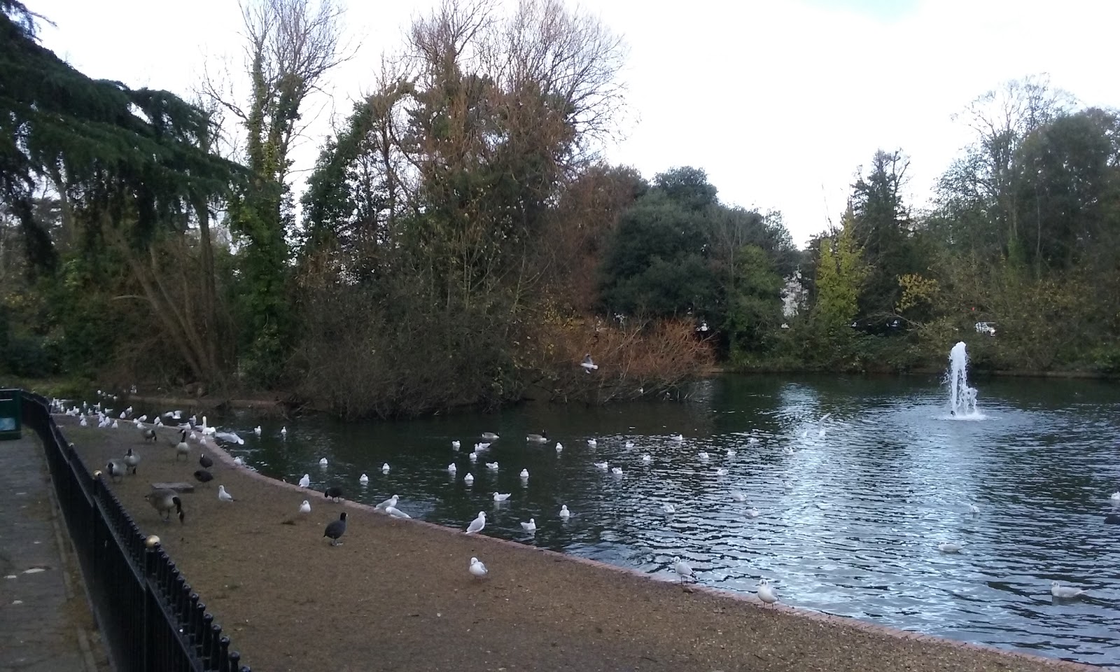
Leaving the canal behind, we followed a gravel path into the Colne Valley Regional Park, passed a lake, crossed a bridge over the River Colne and ended up in Buckinghamshire. There was a peculiar feeling in realising that although our home seems quite far away, it is only at the far end of the neighbouring county.

We followed the course of the river. With river beside us, small lakes nearby and sunshine overhead, this was one of the most attractive sections of the LOOP so far. We stopped to sit on some logs for lunch.

River Colne near Cowley where we ate our lunch

We rejoined the road soon after, and 5 minutes later picked up the Grand Union again, following the towpath until it reached Oxford Road and the end of Section 11. There are many houseboats along these sections of canal, and it is interesting to see the difference between the boats - many are lived in, but while some are beautifully decorated and cared for, others are scruffy and strewn with rubbish and look uncared for.

Section 12 continued beside the canal, passing under the A40 Western Avenue to eventually reach Denham Deep Lock. Near here, I thought I spotted a Kingfisher, but the sighting was very brief and I couldn't be 100% sure. 

Lake, Denham Quarry

Beyond, the canal and river run close together, and a series of lakes formed from former gravel pits sit either side. We wove between the waterways for a while, until finally meeting the Grand Union again at Widewater Lock. The final stretch of walking for this weekend was a simple canal-side walk to the end of Section 12 by the Coy Carp pub. 

Heron beside the Grand Union

We caught a bus back to Uxbridge, where we browsed the shops briefly and went for pizza - a great way to end the long weekend. Again, we'd had a good three days - not classically beautiful walking, perhaps, but always with some interest close by, with wildlife, industrial heritage and scenes from modern life all intermingled with country parks, residential estates, golf courses, woods, rivers, lakes and common spaces. The key is to take the best from what you are seeing around you, because it's never dull!

I'll be planning our next stages soon: one thing is for sure, we are looking forward to it!

London LOOP - Day 5

Tolworth to Cranford

18.81 Miles / 196m Ascent / 185m Descent

Today started with at a brisk pace across frosty grass and a thin skim of ice on the puddles, and ended with a rush to the hotel in the dark. In between was almost 19 miles of walking - beside the Hogsmill River and the River Crane, through the centre of Kingston and over the Thames (last seen 5 walking days ago at Erith) and across busy Bushy Park.

After a cold start, clear skies and sunshine prevailed. We retraced our steps back to where we had left off last night, and picked up the path beside the Hogsmill once again. 

Bright but cold, beside the Hogsmill

Near Cromwell Road, the riverside path appeared to be blocked, so we took the longer detour option via Royal Avenue. Beyond St John the Baptist Church in Old Malden, the two routes rejoined, and, after crossing the A3 again, we traversed the Hogsmill Open Space, bypassed the shops by Berrylands station and followed the streets and alleys into Kingston town centre.

It was time for a break, so we stopped for a coffee in a little cafe just back from the Thames and had a delcious cappucino.

Crossing the Thames - last seen 60-odd miles ago at Erith

After crossing the Thames via Kingstone Bridge (the end of Section 8 of the LOOP) we entered Bushy Park from Church Grove. As it was a Sunday - and a gloriously sunny Sunday, at that - it was pretty busy, but so beautiful and autumnal and warm in the sunshine despite the fact it was late November, who could forgive folks wanting to be out?

Bushy Park in the sunshine

After a short comfort break at the Pheasantry Welcome Centre, we tootled through the woods of the King's River Garden and saw a Greter Spotted Woodpecker and Parakeets in close-up. We have seen many of the birds: obviously, these colonies have established from escaped or abandoned birds, but they seem to be surviving very well indeed. I wonder what food they have found to allow them to thrive so well, and what other species might be losing out as a result? Whatever the situation, they do add a bit of exoticism to the parks and commons round here, and are a heartwarming sight. 

Wild Parakeets

Continuing through the park, we passed the Upper Lodge and exited by the Laurel Road gate. Lunch beckoned, so we detoured into Hampton Hill to see what options were available. Being a Sunday, the choices were limited, but of those available the little Italian restaurant we found looked best. And so it proved: it's amazing what can be done with pasta, tomatoes, garlic and parmesan! 

After lunch, a long walk along the length of Burton's Road brought us to Fulwell Golf Course, We crossed the corner to exit on to Staines Road.

Seen on a wall near Fulwell - presumably this house used to
be a shop or supplier of such goods

Another longish road walk took us through more residential streets until we turned into Crane Park. The River Crane was to be a regular companion over the next day or so - here, the banks were wooded and the paths muddy, and this was pretty much the norm for this river.

One interesting sight cropped up as we walked through the park - the Shot Tower. Apparently, this is the remains of a Gunpowder Mill, built in 1766, and there are not many of them left (I hear the gunpowder trade is not exactly booming at the moment). I wonder what Fred Dibnah would have made of these? A building already primed for self destruction at the end of its life .... 

Shot Tower, Crane Park
    
More road walking followed, then we crossed a recreation ground and entered Hounslow Heath Nature Reserve. We took an indirect route across the heath, regaining the banks of the River Crane after skirting a golf course.

By now, the bright sunshine had faded, and although it wasn't quite dark yet, the overcast skies and overhanging tree canopies conspired to suck the light out of the scene. Although there was the odd bit of detritus strewn in the river, and low-flying jets thundered overhead (we were passing Heathrow Airport) the whole feel of the walk was quite jungle-y.

Weeds in the River Crane

Finally, though, we reached the A30 - the Great South West Road - where Section 9 of the LOOP ended. Having done around 17 miles by this stage, we had a little further to go. With the light fading fast, what we didn't really need was a mile-and-a-half detour to cross the A30 and access to the next bit of the trail blocked by engineering works, although this is exactly what we got. 

Not to worry, we knuckled down, made the detour and found a way through the streets ourselves. A local we met had advised us that part of the route ahead may well be flooded anyway, so perhaps not best tackled in the dark. In the end nothing was detrimental, and we arrived at our hotel in the dark, the street lights around us blazing. 

Besides the Greater Spotted Woodpecker and parakeets mentioned above, today's list of birds also included Little Egrets, another Green Woodpecker and Grey Wagtails.

It had been another good day on the LOOP. OK, so there were some long stretches of road walking and other sections you might not describe as beautiful, but there was often interest, Kingston and Bushy Park in the sunshine had been lovely, and we expected the areas around Heathrow to perhaps be scenically more challenging than, say, Petts Wood. We were tired, but we were also happy, and good progress had been made. We should sleep well tonight.  


Saturday 21 November 2015

London LOOP - Day 4

Coulsdon South to Tolworth 

12.47 miles / 381m Ascent / 436m Descent 

So here we are looping the LOOP again. After a few weeks of other commitments, we have another long weekend in which to explore the green spaces surrounding our capital.

The forecast for the weekend had been good, but it didn't look too promising as we set out at 6.00am amidst the first snow flurries of the winter. Little was settling though, and by the time we reached Euston it was at least dry - if a bit nippy!

For the first section, we were to be accompanied by our friends Nick and Celia, so a rendezvous at Victoria station was organised, followed by a full English to set us up for the day. Suitably fuelled, we set off from Coulsdon South station at around 10.30am. 

Leaving Coulsdon along a sunken path

The first stretch included a long-ish climb up on to the downs, from where great views across London awaited.

Looking across London, with the Wembley Arch clearly visible

We walked through woods, across fields and down lanes, past the Woodcote Smallholdings (built after WW1 as new homes for returning soldiers - Lloyd George's "land fit for heroes") and on to pass through Mayfield Lavender fields. 

Sign explaining about Lavender growing

The sun gradually broke through, and a beautiful autumn morning emerged. We stopped at The Oaks Park for coffee and jam doughnuts, and measured our progress for the morning and our prospects for the days to come.

Progress: Kingston Bridge tomorrow, Uxbridge Lock the day after

Soon after, at a bus stop somewhere near Banstead, we said goodbye to Celia and Nick. It had been a lovely morning, and a real change for us to walk a path like this with friends.

With just ourselves for company, we set off across Banstead Downs. Now, I must admit that for years I had only known of Banstead as the title of an Atomic Rooster song and had never really considered it as an actual town. The song, with its insistant refrain of "Please take me out of this place", suggested bad things, but from what we saw of the Downs (to be fair, mostly the golf course) it didn't seem too awful - although crossing the A217 was a slow business and we could see how it might live up to its sobriquet of the "Mad Mile".

The weather continued to improve during the afternoon, as the route took us through an alternating pattern of golf courses and expensive-looking houses. After passing through Warren Farm and Nonsuch Park, we eventually reached Ewell and stopped for a break in Bourne Hall Park - the end of stage 7 of the LOOP and our second of the day.

Lake, Bourne Hall Park

Then began the last couple of miles to Tolworth and our digs for the night. Walking alongside the Hogsmill River on mostly grassy paths, we spotted Little Egret, Tufted Ducks and a Heron to add to our earlier sightings of a Green Woodpecker and more wild Parakeets.

Stepping stones across the Hogsmill

Darkness was descending as we arrived in Tolworth, but we safely negotiated the underpass beneath the bust A3. We did a quick food shop and made for the hotel. Although it was still quite early, a busy week, another 5.30am start, a few miles walked and lots of fresh air combined to make a lazy evening a very attractive prospect after another good day on the LOOP.


Thursday 22 October 2015

London LOOP - Day 3

Hayes to Coulsdon

16.58 miles / 741m Ascent / 635m Descent

Monday morning in the capital: thousands of workers crammed into trains and buses, headphones on, no social interaction except by phone, everyone alone in a crowd, heading into work. We, on the other hand, are heading out of town in a half-full-at-best train carriage, returning to Hayes to rejoin the LOOP. That's the sort of commute I like!

By 8.00am, we were on the way again, backtracking from Hayes station to West Wickham Common to pick up the LOOP once again. After following a narrow path behind shops, we crossed the road and entered Coney Hall Recreation Ground, where we crossed the Prime Meridian (0˚ Longitude) on a line directly south of Greenwich, one side being the "east" and the other side "west". Imagine that: walking two hemispheres in the same walk!

Crossing the Prime Meridian near
West Wickham Common

We spent the morning passing through a series of open spaces and woods: Sparrows Den Playing Field, Spring Park, Threehalfpenny Wood, Shirley Heath and Kennel Wood, crossing the Borough boundary from Bromley to Croydon along the way. 

Checking the way in Kennel Wood

After a half-mile stretch along Shirley Church Road (nice houses) we skirted a school, crossed into Oaks Road and turned left into Addingham Hills, London's largest surviving area of heathland, with great views across the capital from the viewing platform, including Canary Wharf and the 02 arena.

Coombe Lane, Heathfield House and Bramley Bank Nature Reserve came and went. We stopped for elevenses about an hour early, sitting on a bench by Broadcoombe. 

As we crossed an open grassy area on the way to Littleheath Woods, we were halted by an elderly couple. "Are you doing the LOOP?" they asked. We got chatting: they had done it and really enjoyed it, had gone on to do the Capital Ring as well, and were in the process of walking the Thames Path. It seems that those who undertake these walks are often pleasantly surprised and inspired to do more!

Sweet Chestnuts, Littleheath Wood

The path through Selsdon followed a gravel path between the houses before climbing into Selsdon Wood. We stopped briefly for something to eat. Since starting at 8.00am, we had been expecting to pass some shops where we could buy bread, but such is the desire of the path to avoid "civilisation" it was five hours before we passed one!

Through Puplet Wood, past Elm farm, across Mossyhill Shaw: we picked up Kingswood Lane, eventually coming out in Hamsey Green - the end of Section 4 of the LOOP. By now we had completed over 10 miles and were quite hungry, so we stopped at a nearby greasy spoon for lunch and topped up our food supply at the adjacent shop.

Looking across Riddlesdown to Whyteleaf 

Back on the path, we were soon back into the countryside - crossing Riddlesdown, descending to Kenley, the steep climb up again to Kenly Common, by Betts Mead Recreation Ground. Just after the pub on Fox Lane, we walked into a large open space and down into Happy Valley.

A happy chap near Happy Valley

Happy Valley

After passing through Devilsden Woods, we came out into the open on Farthing Downs. The end of our trip was in sight, but the all round views were a real treat at end the day. 

Descending towards Coulsdon

The descent into Coulsdon was easy enough, and a few turns later we were crossing the bridge to the station, just in time to catch the 4.30pm into London Victoria.

Coulsdon South station

From Victoria, we caught the tube to Euston and walked to St Pancras. On the way, we called in at the British Library, and ate our snack in the plaza outside.

Statue of Sir Isaac Newton outside the British Library

As Sir Isaac Newton, mathematician, physicist and scientific genius, sat concentrating on his geometry, so we sat and contemplated the 3-day arc of the London LOOP circle we had just described. Started as something of an experiment on our part, we had really enjoyed our long weekend. The transport links had worked well, the path was interesting throughout and greener and more rural than we expected, and the going underfoot ideal for a wintertime walking project.

There and then we decided: we'll be back for more. And it didn't take a genius to work out why!


Sunday 18 October 2015

London LOOP - Day 2

Sidcup to Hayes

15.01 miles / 484m Ascent / 385m Descent

Our second day on the LOOP began inauspiciously with the negotiation of a complex underpass beneath the Sidcup Bypass, and the entrance into Scadbury Nature Reserve offered little in the way of promise. 

Entering Scadbury Nature Reserve

As happens so often on this walk, though, appearances can be deceptive, and in but a few moments we were back amongst the trees with only the distant drone of traffic to remind us we were actually on the fringe of a city of eight-and-a-half million people.

Walking through the trees

A slight detour took us to the ruins of Scadbury Manor, a medieval moated manor house with a 600+ year history, currently undergoing excavation and resoration. It is most associated with the Walsingham family (from Walsingham, Norfolk) who purchased the house in 1424.

Scadbury Manor

The next few miles were given to wandering through an assortment of woods. Some of the land is owned by the National Trust, including Petts Wood.

Marker stone, Petts Wood

After crossing a series of railway lines, we reached Jubilee Country Park near Petts Wood station - the end of Section 2 of the LOOP - and took a break to eat. This was the only point we really went wrong over the entire three days: in looking for a seat, we missed the turn and the description fitted our "wrong" route as well as the right one, so we didn't spot that for a few minutes.

No damage done, we were back on track shortly afterwards. On that note, we found that although there were numerous paths in some places, the route notes and maps supplied by TfL, along with the on-path signage, were pretty good for navigating by cleanly - as long as you checked them regularly and kept your wits about you. There were also occasional information boards along the route to add extra information. 

Information board, Crofton Woods

Beyond Jubilee Country Park was a section of road walking - one of the few we encountered - along the quiet residential streets of Southborough. What was a revelation to us was just how little road walking there was on the LOOP - obviously, there was some, but wherever possible, the route kept to paths and tracks through woods, common land, meadows, heath, etc, and today we walked for 15 miles with maybe 10% of that on pavements.

Meadows beyond Darrick Wood

We stopped for a break at an open grassy area beyond Darrick Wood, with Farnborough in the near distance and the North Downs on the horizon. Autumn is a good time of year to tackle the LOOP: there is so much woodland walking en route that a colourful display of foliage is almost guaranteed - especially when the sun shines.

Autumn colours, Darrick Wood

Crossing Farnborough Way was a slow business - where was everyone going? - but eventually we were safely across, making our way through the village.

The flint-and-red-brick-built church of St Giles the Abbot

Shortly afterwards, we entered High Elms Country Park, and stopped for a cream tea at the BEECHE Centre - an environmentally-friendly building housing a cafe and education centre. Naughty, but nice: we had walked a fair way, though, and were in need of a tonic!

Past the High Elms Golf Club, we entered a rural section passing through fields and green lanes (surely Bogey Lane, the green lane running beside the Golf Club, must have been named after the course was established?). 

Holwood House

Next, we skirted the grounds of Holwood House. It's for sale (yours for £12 million) but we decided against it (too far from our friends and family). This particular incarnation of the house was built in the 1820s, but the previous house had belonged to William Pitt the Younger, and it was here that William Wilberforce is said to have told Pitt of his intention to abolish slavery.

Notes from Wilberforce's diary

The Wilberforce Oak marks the spot. The original tree is rather worse for wear, but a new tree has been planted in continuing commemoration of the event.

The original Wilberforce Oak

Descending to Westerham Road, we crossed to pass beside Keston Ponds - like many of the recreational spaces today, busy with familes and dog walkers - and on through Keston village. A mile or so later, we reached west Wickham Common - the end of Section 3 of the LOOP and our stopping point for the day.

We made the 10 minute walk to Hayes station - our accommodation was a couple of stops away - to find a rail replacement bus service was running. They were frequent enough, so gave us time for a delicious curry before heading to our hotel.

Saturday 17 October 2015

London LOOP - Day 1

Erith to Sidcup

13.77 miles / 252m Ascent / 185m Descent

If you'd have told me three months ago I'd be walking in London by choice and enjoying it, I'd have recommended you get your head tested. My dislike of towns, and of the outer reaches of our capital in particular, are legendary.

But back in August we were visiting friends, and were enjoying a nice little walk round Kingston and Bushey Park when we came across signs for the London LOOP (London Outer Orbital Path). Further investigations proved interesting, and before we knew it, we'd decided we might give it a go sometime.

Well, that sometime is now!

The route runs in a clockwise direction from Erith in Kent all the way round to Purfleet in Essex, and has been described as "the M25 for walkers" (not a great way of selling it to those of us who have spent considerable time parked on said road). But aside from the fact it encircles the capital in similar fashion, there is little resemblance as the LOOP has been designed with discovery in mind and interest aplenty, linking green spaces and quiet thoroughfares, and not simply taking the most direct route.  

The whole route has been designed to be doable using public transport, and has been divided into 24 sections each of which link with overground rail, the underground system and local bus networks. The full walk is detailed on the Transport for London (TfL) website - each of the 24 sections has a downloadable pdf with walk descriptions, maps, notes, transport details and other useful information, and along with the on-path signage, these are sufficient to navigate the path successfully (click the TfL link on right hand side of the home page for more details).  

Erith Station

After an early start, we alighted at Erith Station under a leaden grey sky. It isn't perhaps the most auspicious of starting points, but we found signs for the walk straight away, which is always handy.

The obligatory start-of-walk photo

We passed through some municipal gardens, made a quick stop at Morrisons to grab a few vittals, then picked up the path beside the Thames - initially heading East towards Crayford Marshes. The tide was out, and across the muddy banks and sluggish brown water we could see Canary Wharf one way and the Dartford Crossing the other. In the foreground, the river was peppered with small sailing boats, whilst the odd large tanker slid slowly by in the middle distance.

Looking back towards the capital beyond a flotilla of small boats


Checking the way


Seals lazing on the muddy bank

On reaching the Cray River, we turned away from the Thames - the last time we would see the river until we cross Kingston Bridge some 70-odd miles later. Initially tidal, we followed the course upstream towards Crayford where a slim river pushed it's way between tree-fringed banks.

These initial miles were interesting, but not always pretty. Besides Seals, we saw Kestrels, Cormorants, assorted Waders and Little Egrets - there was no shortage of wildlife. It would have been nice to say that the flashes of bright blue and orange we saw by the river were Kingfishers, but sadly not - empty pop bottles and old footballs were the culprits here, strewn amongst the cliche of abandoned shopping trolleys.

Playing fields near Crayford

However, this didn't last for too long. Beyond Crayford, where we stopped for coffee in a greasy spoon, things improved. Crossing the playing fields to rejoin the river, we followed this towards Hall Place (a Tudor mansion, built in the reign of Henry VIII for the Lord Mayor of London).

Hall Place from the gardens

Cottage garden, Hall Place

Reality intruded again briefly as we crossed over and under the main A2 road, but soon all that was noticable was the thrum of traffic receding into the distance as we delved deeper into Churchfield Wood. 

Bexley Village was a pleasant surprise. We don't really know this area, and much of this was new to us. We rested a while on a bench in the churchyard of St Mary the Virgin, at some lunch and watched squirrels playing. 

Autumn hedgerow near Bexley Village

Bexley Village marked the end of Section 1 of the LOOP. With it's air of bohemian chic and a wide range of interesting-looking eateries, it would be a fine place to end the day. But we were carrying on to complete half of Section 2 as well - past Bexley Cricket Club, across an open field and down to join the River Cray once again in Foots Cray meadows.

River Cray

We'd already seen a variety of wildlife during the walk, but Foots Cray meadows provided a first for us - Parakeets! We knew that birds like these had escaped from captivity or been let loose and had survived - even thrived - in the wild. But we'd no idea it was here!

Parakeets in the wild! Hard to see against the colour of the trees,
but there are 3 or 4 birds in this photograph

Passing through Foots Cray, we negotiated a short urban section as we skirted the ground of Cray Wanderers Football Club (formed in 1860, and one of the earliest football clubs in the country). Soon, though, we reached the open grassy area of Sidcup Place. It looks a bit like a golf course, but with no one struggling to propel a little white ball into a small hole with a stick.

Mature Redwood Tree, Sidcup Place

Mark Twain is reputed to have claimed that "golf is a good walk spoiled". Well, I don't know about that, but we'd certainly had a good walk. Sidcup was our stopping point for the day, and our hotel beckoned. 

Never having been to Sidcup before, we were unsure of what to expect. In fact, it's nice enough - we had pizza for dinner, and enjoyed an evening trundle along the high street. We popped into a nearby Waitrose store to buy provisions for tomorrow and were amused to find that "Rosemary and Sea Salt Focaccia" was considered part of their "Essentials" range. I don't know - what is the world coming to that it that considers such an exotic foodstuff "essential"? 

Tasted nice, though!   

NB. This post was originally blogged "live" - the first time I've done so "on the go" - using my phone and the blogger app. Seems to work quite well for short posts, although I still like to tidy them up and flesh them out afterwards.